
To inform the next stage of detailed design planning for Westport, we are collecting data about the sub-sea conditions in the area where the development is proposed.
Marine geotechnical investigations involve drilling below the seabed to collect soil and rock samples. This allows us to assess the underground composition and condition of the area, ensuring safe, efficient, and reliable design for future construction.
The area we are investigating includes the footprint of the port terminal and shipping channel to the north.
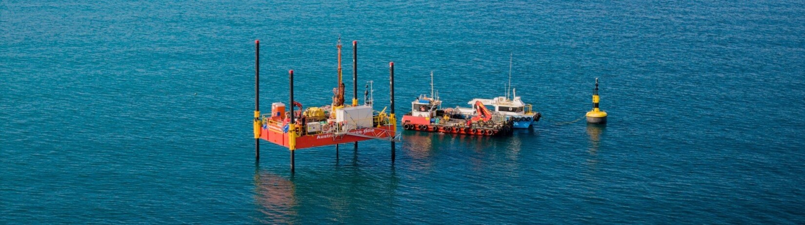
The investigations are being carried out from two jack-up barges, scheduled to operate across the area from mid-2025 through to mid-2026.
As part of the marine geotechnical investigations, a marine vessel will be in the area for two weeks in late July to early August to carry out cone penetration testing. This involves pushing a probe into the seabed to measure soil resistance. The vessel will operate 24 hours a day during this period to complete the work efficiently.
Early investigations using sound waves
Before scoping geotechnical investigations, we carried out geophysical surveys in the same area using sound waves to map the subsea area.
These earlier surveys gave us a broad picture of what’s beneath the seabed, including identifying the topography and magnetic and density properties of rock layers. However, to progress the engineering and final designs, we now need the physical samples and detailed data.
Frequently asked questions
Marine geotechnical investigations are an investigation of the ground beneath a project site. It helps engineers understand the soil and rock conditions so that infrastructure can be designed to be safe, stable, and long-lasting.
The investigations involve drilling boreholes and bringing up core samples, which are then tested in a laboratory. This process helps us understand the strength, type, and stability of the ground beneath the surface.
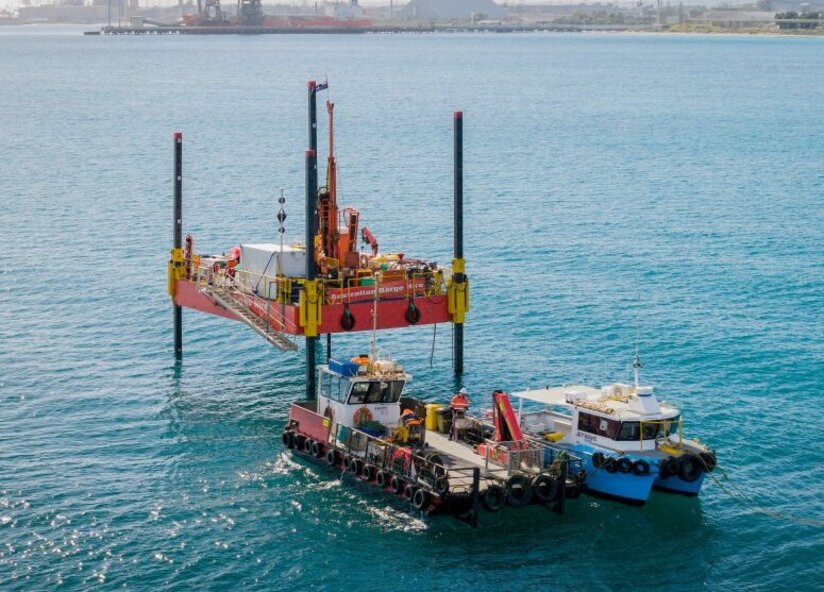
The investigations will be conducted throughout the proposed port terminal footprint area and navigation channel (see map). A tugboat will move the jack-up barges progressively through the area to ensure sufficient ground samples are collected across the site.

A jack-up barge is a type of floating platform equipped with legs that lower to the seabed and raise the platform above the water’s surface. This creates a stable base for drilling and other investigation work. See image below.
Yes. All activities avoid seagrass meadows and follow strict environmental management plans to avoid harm to the marine ecosystem.
There may be some noise and minor vibration from drilling equipment, but it is limited and temporary. All operations follow environmental guidelines to control impacts, including spill prevention.
There is a 50m buffer zone established around the jack-up barge to keep everyone safe. We also communicate with local marine users and authorities to coordinate activities.
Where appropriate, we’ll share summary findings through project updates, newsletters and stakeholder briefings – especially if they influence design or timing.
